Welcome to Stiperstones
The Unmistakable Silhouette of Shropshire
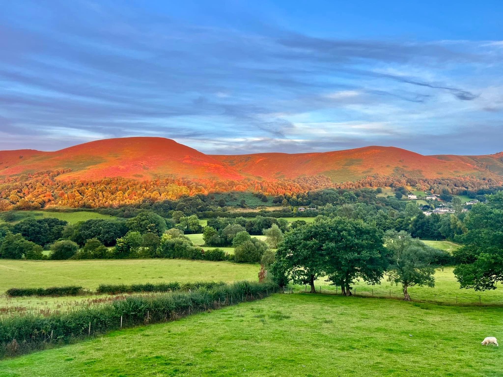
The Stiperstones is a spectacular and defining geographical feature in south-west Shropshire, presenting a rugged and unmistakable silhouette that rises to 536 metres (1,759 ft) above sea level. As the second-highest hill in the county, surpassed only by Brown Clee Hill, the Stiperstones ridge spans approximately 10 kilometres and is a prominent landmark within the Shropshire Hills Area of Outstanding Natural Beauty (AONB). Much of this dramatic landscape is a designated National Nature Reserve (NNR) and a Site of Special Scientific Interest (SSSI), recognized for its exceptional fusion of geological, ecological, and cultural attributes. This overview traces the interconnected threads of its natural history, human heritage, and the enduring folklore that shapes its identity.
Geological Foundations: Tors, Periglacial Landscapes, and Deep Time
The striking physical character of the Stiperstones is the result of geological processes that have unfolded over hundreds of millions of years, culminating in a landscape of remarkable and singular appearance. The fundamental structure of the ridge is formed from the Stiperstones Quartzite Formation, a heavily faulted, grey-white quartzose sandstone of Ordovician age. This rock unit, which dips steeply to the WNW, was formed approximately 480 million years ago and is between 120 and 325 metres thick. The western slopes of the hill are composed of the overlying Mytton Flag Formation, while the eastern slopes are defined by the older mudstones of the Shineton Shale Formation, creating a complex stratigraphy across the ridge.
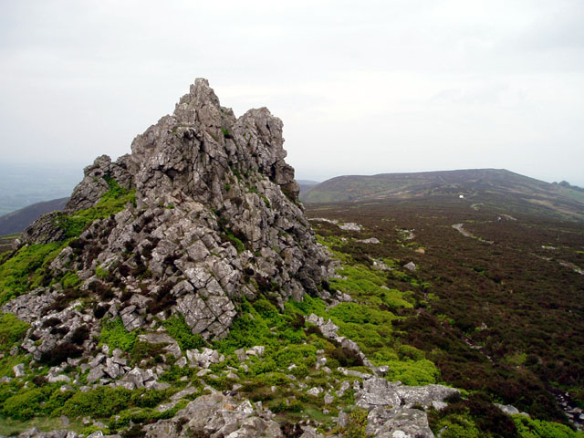
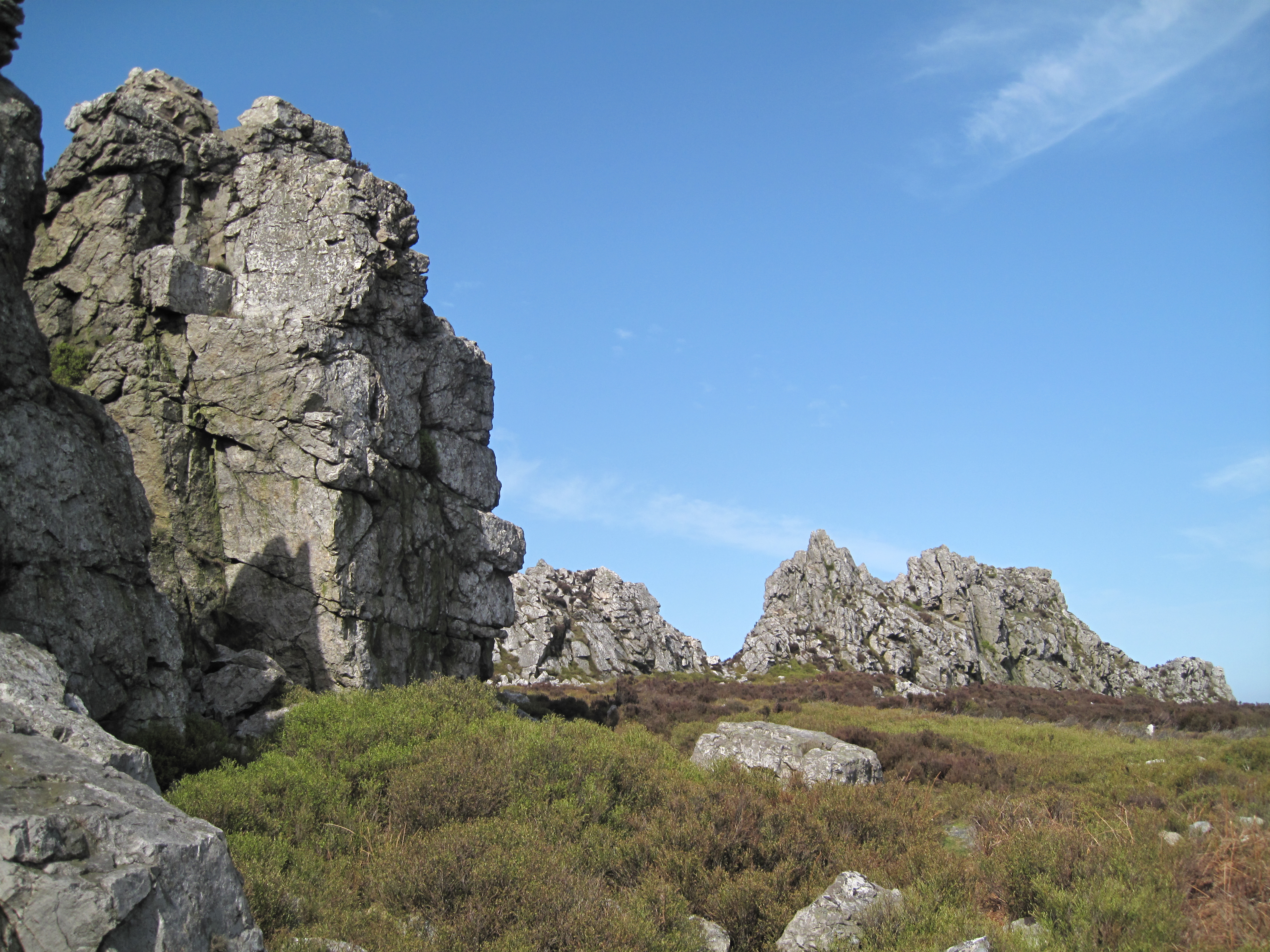
The most dramatic features of the landscape, the tors and boulder-strewn scree fields, were sculpted not by direct glaciation but by the intense periglacial conditions of the last Ice Age. While the Stiperstones ridge itself was not covered by the Welsh ice sheet, which lay to its west, it was subjected to cycles of severe freezing and thawing. This action fractured the more brittle quartzite, producing the jumbled masses of scree that surround the residual, more resistant rock outcrops that we see today. Below the prominent tors, the forces of water, frost, and gravity worked in concert to create patterned ground, including stone stripes and polygons, recognized as some of the finest examples of these periglacial features in England.
The principal tors, which crown the summit ridge, are landmarks in their own right, each with a unique identity. From north-east to south-west, they are known as Shepherd’s Rock, Devil’s Chair, Manstone Rock, Cranberry Rock, Nipstone Rock, and The Rock. Manstone Rock holds the distinction of being the highest point on the ridge, reaching 536 metres and marked by a trig point, while the Devil’s Chair is celebrated as the largest and most widely recognized of the outcrops.
| Name | Grid Reference | Elevation | Notable Feature(s) |
|---|---|---|---|
| Shepherd’s Rock | SO373998 | — | Northernmost of the major tors. |
| Devil’s Chair | SO368991 | — | The largest and best-known outcrop; a focus of folklore. |
| Manstone Rock | SO367986 | 536 m (1,759 ft) | Highest point on the ridge with a trig point. |
| Cranberry Rock | SO365981 | — | Near the southerly end of the main ridge walk. |
| Nipstone Rock | SO365969 | — | On a detached section to the south. |
| The Rock | SO351963 | — | Southernmost of the named outcrops. |